 - L5 from Here, 2015-ONGOING. A series of photographs from Earth of Lagrange point 5, where space colonies are planned
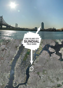 - Long Island City Sundial Field Guide, 2013. Book tracking the Citicorp building's shadow to tell time
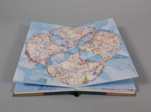 - Atlas Dream Sequence, 2011. Each map-collage page is an imagined magnification from the previous page
 - Manhattanhenge, 2009. Print showing where, twice a year, the setting sun aligns with the Manhattan street grid
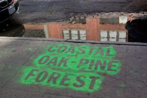 - Forest & Stream, 2009. With Nicholas Fraser, labels of previous forest types were placed in location on Manhattan
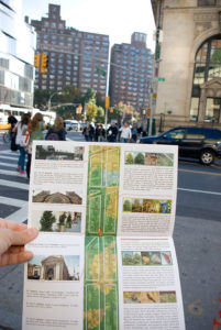 - Urban Forest on 14th Street, 2009. 5.5 x 8.5 in., 12 pages. Urban Forest on 14th Street is a self-guided walking tour comparing today's 14th street in Manhattan to the same place 400 years ago, based on data from the Mannahatta Project.
 - Numerous collage pieces made from maps involving the manipulation of the documented space in maps.